From lines to lights: how Traffic Services keeps our city moving
April 3rd, 2024
April 3rd, 2024
This story is part of the City of Ottawa Service Reviews: an initiative aimed at ensuring our services are meeting your needs. Visit ottawa.ca/YourIdeas today.
Everyone in Ottawa uses our roads in some way, whether as a cyclist commuting to work, a student walking to school, or a delivery driver motoring all over town. Our Traffic Services team strives to keep everyone and everything moving safely and effectively through our city by:
Everyone in Ottawa uses our roads in some way, whether as a cyclist commuting to work, a student walking to school, or a delivery driver motoring all over town. Our Traffic Services team strives to keep everyone and everything moving safely and effectively through our city by:
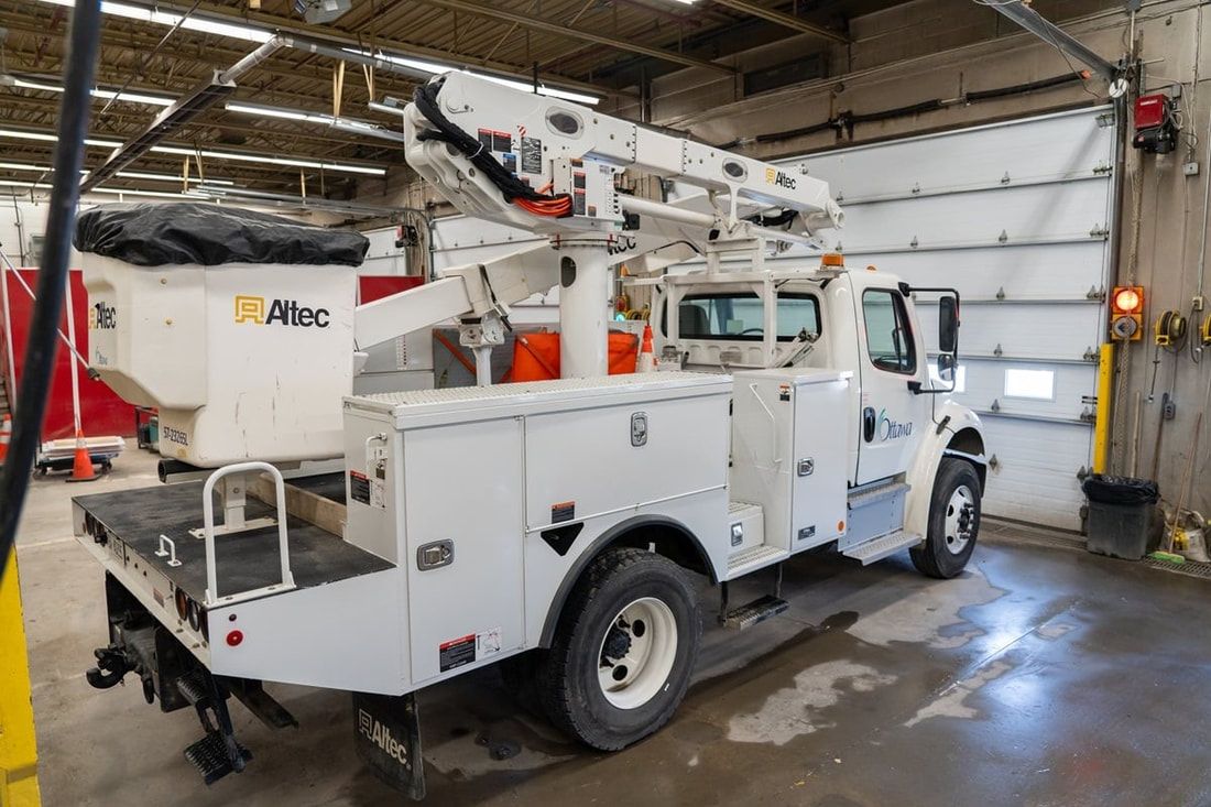
- Installing and maintaining signs and pavement markings
- Monitoring traffic
- Performing traffic investigations, inspections and counts
- Analyzing collisions
- Providing traffic and road safety engineering, traffic management and street lighting expertise
- Designing and maintaining the operation of streetlights
- Providing road closure special event permits
- Assisting with storm recovery efforts by mobilizing temporary power at major signalized intersections and supporting our hydro partners in reinstating power
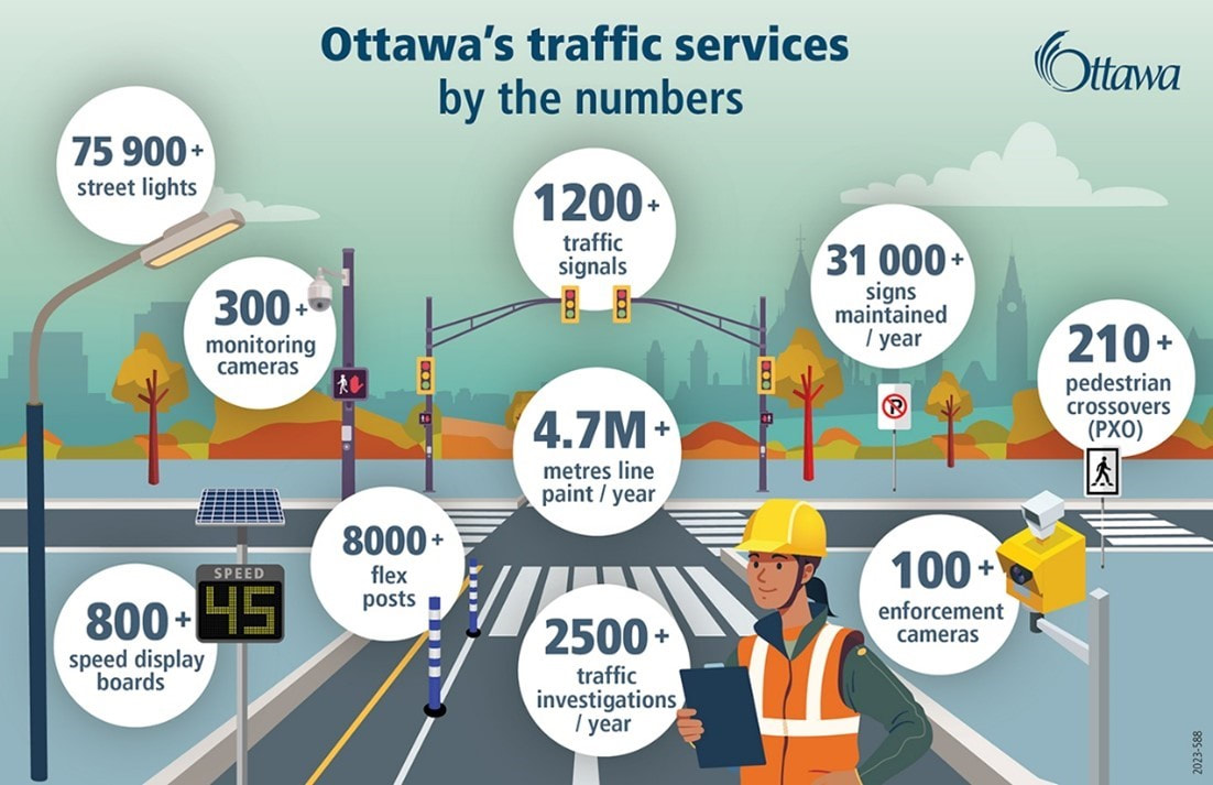 This infographic is a snapshot of the range and scale of traffic services installation and maintenance work in 2023.
Traffic Services’ beating heart
At the heart of the City’s traffic operations is the Traffic Control Centre. It operates from 6 am until 7 pm, Monday to Friday, with an on-call team available 24 hours day, seven days a week. Monitoring is also extended into evenings and weekends for special events that may cause significant disruptions to normal traffic patterns.
At the heart of the City’s traffic operations is the Traffic Control Centre. It operates from 6 am until 7 pm, Monday to Friday, with an on-call team available 24 hours day, seven days a week. Monitoring is also extended into evenings and weekends for special events that may cause significant disruptions to normal traffic patterns.
Seasonal flow of tasks and staff
Spring is here! Time to install new signage (once the ground thaws), repaint fading road lines and install bike lane delineators, among many other tasks on the City’s spring to-do list. This seasonal transition to spring/summer work typically occurs in April and to fall/winter work in November. It’s a multi-step change in the operation of some of our heavy equipment and the roles of some of our staff. It also requires coordination across various functions. For example, painting lines or installing temporary traffic calming measures can only be done following spring street sweeping, which is carried out by another Public Works team.
Spring is here! Time to install new signage (once the ground thaws), repaint fading road lines and install bike lane delineators, among many other tasks on the City’s spring to-do list. This seasonal transition to spring/summer work typically occurs in April and to fall/winter work in November. It’s a multi-step change in the operation of some of our heavy equipment and the roles of some of our staff. It also requires coordination across various functions. For example, painting lines or installing temporary traffic calming measures can only be done following spring street sweeping, which is carried out by another Public Works team.
Putting it on the line
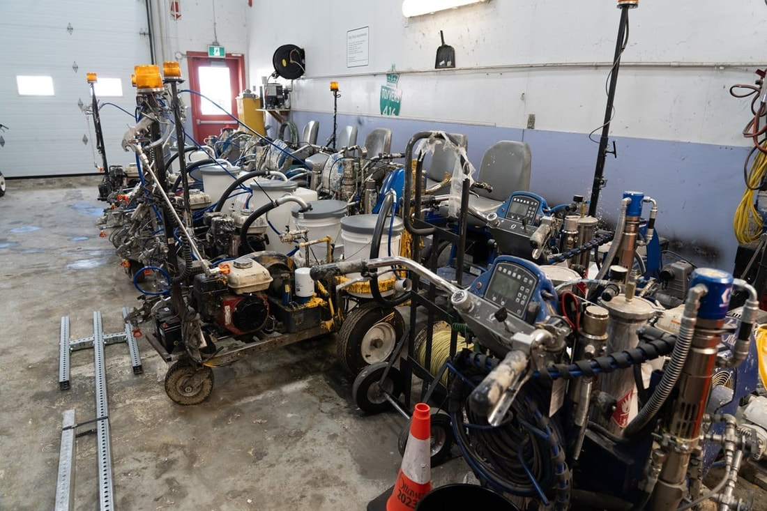
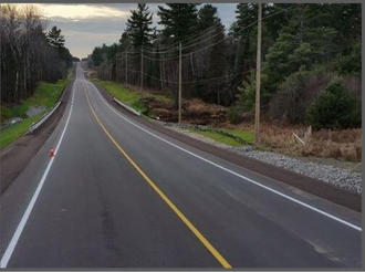
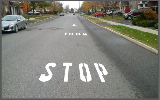
Who would guess that there are more than 4.7 million metres – or 4,700 kilometres – of lines on Ottawa’s roads? Traffic Services paints and maintains all centreline, lane line and edge line markings. Twice a year, the team also paints the surface markings at traffic control signals, school crossings and stop sign intersections
Who would guess that there are more than 4.7 million metres – or 4,700 kilometres – of lines on Ottawa’s roads? Traffic Services paints and maintains all centreline, lane line and edge line markings. Twice a year, the team also paints the surface markings at traffic control signals, school crossings and stop sign intersections
Staying on top of planned and unplanned traffic conditions
You can stay on top of anything happening on our streets with a City webpage detailing any upcoming major traffic impacts. These are mostly related to planned construction and special events, like Canada Day celebrations. Our interactive traffic map also provides that information as well as timely data on unplanned impacts caused by collisions or weather events. In addition, the map pinpoints the locations of parking lots, park-and-ride lots, automated speed enforcement cameras, red light cameras and more.
Converting the entire town
Our streetlight conversion team recently finished replacing more than 58,000 streetlight fixtures with LED lighting and monitoring technology. The newer technology provides more consistent light, a prolonged life expectancy and less down time for each streetlight. The benefits include reduced light pollution, reduced energy consumption, reduced greenhouse gas emissions and substantial cost savings. Last week, the project and its team won the City’s Environmental Excellence Award for helping build a greener and more sustainable municipality.
It's all in the timing
Our operators continuously monitor traffic controls at the city’s more than 1,200 signalized intersections. Signal timing is set with the goals of:
When needed, operators can immediately adjust the traffic signal timing and phasing for key intersections. When a problem is detected by the system or reported by the public, an operator resolves it or immediately dispatches it to maintenance crews.
You can stay on top of anything happening on our streets with a City webpage detailing any upcoming major traffic impacts. These are mostly related to planned construction and special events, like Canada Day celebrations. Our interactive traffic map also provides that information as well as timely data on unplanned impacts caused by collisions or weather events. In addition, the map pinpoints the locations of parking lots, park-and-ride lots, automated speed enforcement cameras, red light cameras and more.
Converting the entire town
Our streetlight conversion team recently finished replacing more than 58,000 streetlight fixtures with LED lighting and monitoring technology. The newer technology provides more consistent light, a prolonged life expectancy and less down time for each streetlight. The benefits include reduced light pollution, reduced energy consumption, reduced greenhouse gas emissions and substantial cost savings. Last week, the project and its team won the City’s Environmental Excellence Award for helping build a greener and more sustainable municipality.
It's all in the timing
Our operators continuously monitor traffic controls at the city’s more than 1,200 signalized intersections. Signal timing is set with the goals of:
- Improving traffic flow
- Keeping all road users safe
- Reducing idling and the resulting emissions, to improve air quality
When needed, operators can immediately adjust the traffic signal timing and phasing for key intersections. When a problem is detected by the system or reported by the public, an operator resolves it or immediately dispatches it to maintenance crews.
Signs, signs, everywhere a sign
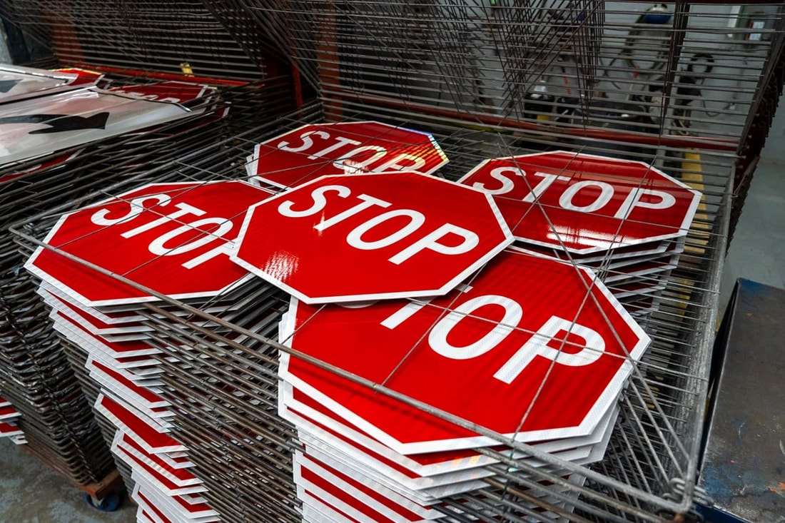
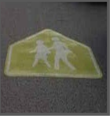
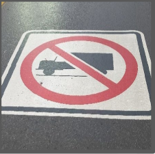
The City has many kinds of signs. We maintain more than 31,000 signs annually, including ones for speed limits, school zones, truck routes, parking and more.
The City has many kinds of signs. We maintain more than 31,000 signs annually, including ones for speed limits, school zones, truck routes, parking and more.
How data drives us
The City is increasingly data driven, as we aim to improve road safety for all and advance towards ‘vision zero’ – zero fatalities and major injuries on our streets. The City receives data on collisions that occur in Ottawa from the Ministry of Transportation (MTO) on a continual basis. The data is validated through the City’s collision management system to ensure there are no errors or missing information. Available collision data is publicly released via OpenData Ottawa once validated.
The City also collects, validates and analyzes:
The data is collected by equipment temporarily installed for the length of time observations are required, which may be as little as 24 hours. The data helps inform road safety programs, transportation planning, traffic investigations, traffic management, transportation operations, asset management and research by external organizations. In 2023, the team processed requests for new traffic data at 2031 locations.
Your city, your ideas!
We hope you learned something new about our City’s Traffic Services! Do you have creative ideas on how we can help shape the City’s traffic system work in the future, and find potential cost savings while doing it? Visit engage.ottawa.ca/ConnectedCity today.
The City is increasingly data driven, as we aim to improve road safety for all and advance towards ‘vision zero’ – zero fatalities and major injuries on our streets. The City receives data on collisions that occur in Ottawa from the Ministry of Transportation (MTO) on a continual basis. The data is validated through the City’s collision management system to ensure there are no errors or missing information. Available collision data is publicly released via OpenData Ottawa once validated.
The City also collects, validates and analyzes:
- Vehicle speeds
- Vehicle volume, both at intersections and mid-block
- Vehicle direction at intersections, whether turning right or left or proceeding straight
- Vehicle classification, such as regular vehicles, trucks or bicycles
The data is collected by equipment temporarily installed for the length of time observations are required, which may be as little as 24 hours. The data helps inform road safety programs, transportation planning, traffic investigations, traffic management, transportation operations, asset management and research by external organizations. In 2023, the team processed requests for new traffic data at 2031 locations.
Your city, your ideas!
We hope you learned something new about our City’s Traffic Services! Do you have creative ideas on how we can help shape the City’s traffic system work in the future, and find potential cost savings while doing it? Visit engage.ottawa.ca/ConnectedCity today.
Speed limit change on Terry Fox Drive
December 13th, 2023
December 13th, 2023
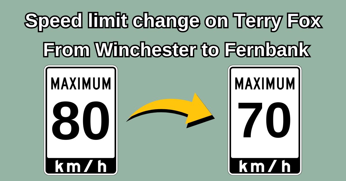
Changes are being made to the speed limit on Terry Fox Drive between Winchester Dr. to Fernbank Road.
This change will reduce the 80km/hr portions of Terry Fox to 70 km/hr which will make the speed limit on Terry Fox 70 km/hr from the 417 to Fernbank Road.
City Staff will be installing the new signage today and the speed limit change will take effect once the signs have been installed.
This change will reduce the 80km/hr portions of Terry Fox to 70 km/hr which will make the speed limit on Terry Fox 70 km/hr from the 417 to Fernbank Road.
City Staff will be installing the new signage today and the speed limit change will take effect once the signs have been installed.
Road Safety Action Plan
- Between 2017 and 2021, aggressive driving behaviours of at least 209 drivers was a contributing factor in fatal and major injury collisions in Ottawa.
- Aggressive driving can include many unsafe actions while behind the wheel. Those most often contributing to fatal and major injury collisions include: failure to yield the right of way, loss of control, speeding, disobeying traffic control, and improper turning or passing.
- All drivers must respect these traffic laws. Practicing a few simple habits can help maintain a positive attitude while behind the wheel:
- Plan ahead; allow yourself ample travel time to account for delays.
- Obey the speed limit and traffic control devices at all times, even if you’re late to your destination.
- Learn several alternate routes to your trip.
- Maintain a calm attitude even if other drivers are not – escalation is not worth endangering lives.
- Report all aggressive driving behaviour, including speeding, through the Ottawa Police Service online reporting system.
- No matter how you choose to get around, please be respectful of all other road users. To learn more about the City’s Road Safety Action Plan, and the many initiatives underway to increase safety for all road users, visit Road Safety Action Plan | City of Ottawa
- Be Safe, Be Seen! Throughout October @SROttawa & @OttFire are giving away reflectors and lights to #OttCity pedestrians and cyclists. For pick up times and locations visit Ottawa.ca/BeSafeBeSeen #ThinkSafetyActSafely
June 1st, 2023
Please see below for important information regarding Speed Board Data in Kanata South.
Please see below for important information regarding Speed Board Data in Kanata South.
Your browser does not support viewing this document. Click here to download the document.
February 23, 2023
I wanted to share some information about the new automated speed enforcement camera being deployed in the ward. The new location will be on Stonehaven Dr. between Bridle Park Dr. and Tandalee Cres. This location is ideal as it will help mitigate traffic speeds for 3 schools, St- Anne, Elizabeth Bruyère and Roch Carrier. Deploying this camera will require the removal of the two existing school zone flashers, Stonehaven south of Stonemeadow and Stonehaven east of Grassy Plains. The work has a tentative completion date of end of year, 2023.
If you are looking for any additional information, this website has a lot of useful material including frequently asked questions https://www.aseontario.com/
If you have any other questions, please don't hesitate to reach out to the office at 613-580-2752 or [email protected]
April 11, 2023
Hi folks, I wanted to share some information regarding the traffic light timing for the intersection of Terry Fox and Hazeldean. Residents have been reporting that there have been some issues with this intersection, the traffic team assessed and concluded that this is due to a broken in-ground vehicle sensor. As a result, the signal timing is not ideal and does not interact optimally with the Sobeys intersection which leads to vehicle queuing. The sensors will be replaced once the ground thaws (and the weather warms up).
We are working closely with traffic and will provide updates when they are made available. Thank you for your patience
February 23, 2023
I wanted to share some information about the new automated speed enforcement camera being deployed in the ward. The ASE camera location will be on Stonehaven Dr. between Bridle Park Dr. and Tandalee Cres. This location is ideal as it will help mitigate traffic speeds for 3 schools, St- Anne, Elizabeth Bruyère and Roch Carrier. Deploying these cameras will require the removal of two existing school zone flashers, Stonehaven south of Stonemeadow and Stonehaven east of Grassy Plains.
ASE cameras were effective at reducing traffic speeds. Based on the review of data collected during the pilot project, speed reductions were observed at all sites. On average, in the first year of operation, sites experienced:
If you are looking for any additional information, this website has a lot of useful material including frequently asked questions https://www.aseontario.com/
For detailed information on the ASE pilot, the report to council can be found here.
I wanted to share some information about the new automated speed enforcement camera being deployed in the ward. The ASE camera location will be on Stonehaven Dr. between Bridle Park Dr. and Tandalee Cres. This location is ideal as it will help mitigate traffic speeds for 3 schools, St- Anne, Elizabeth Bruyère and Roch Carrier. Deploying these cameras will require the removal of two existing school zone flashers, Stonehaven south of Stonemeadow and Stonehaven east of Grassy Plains.
ASE cameras were effective at reducing traffic speeds. Based on the review of data collected during the pilot project, speed reductions were observed at all sites. On average, in the first year of operation, sites experienced:
- 200 percent increase in compliance with the speed limit;
- 11 percent decrease in 85th percentile speed; and,
- 72 percent decrease in percentage of high-end speeders.
If you are looking for any additional information, this website has a lot of useful material including frequently asked questions https://www.aseontario.com/
For detailed information on the ASE pilot, the report to council can be found here.
Overview
Speeding and driver behaviour are major concerns for residents within Ottawa. Each year, numerous inquiries are received in pursuit of traffic calming measures to address these issues. Unfortunately, permanent roadway modifications are not always a viable solution. Some locations of concern may not meet the necessary criteria for permanent modifications or in certain instances, the impacts of such modifications are undesirable.
The Temporary Traffic Calming Measures (TTCM) Program facilitates the installation of effective, low cost traffic calming measures that are temporary and/or seasonal in nature. These are quickly and easily installed and can be easily modified where applicable. TTCM offer safety solutions for areas that often do not meet criteria for permanent roadway modifications.
Temporary Traffic Calming OptionsTraffic calming measures currently considered as part of the Temporary Traffic Calming Measures Program are the following:
The following measures may be considered on a case-by-case basis as part of the TTCMP and will be subject to the same location restrictions identified in the City’s Traffic Calming Design Guidelines:
Speeding and driver behaviour are major concerns for residents within Ottawa. Each year, numerous inquiries are received in pursuit of traffic calming measures to address these issues. Unfortunately, permanent roadway modifications are not always a viable solution. Some locations of concern may not meet the necessary criteria for permanent modifications or in certain instances, the impacts of such modifications are undesirable.
The Temporary Traffic Calming Measures (TTCM) Program facilitates the installation of effective, low cost traffic calming measures that are temporary and/or seasonal in nature. These are quickly and easily installed and can be easily modified where applicable. TTCM offer safety solutions for areas that often do not meet criteria for permanent roadway modifications.
Temporary Traffic Calming OptionsTraffic calming measures currently considered as part of the Temporary Traffic Calming Measures Program are the following:
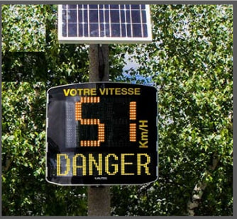
- Speed display devices (permanent or temporary)
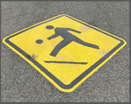
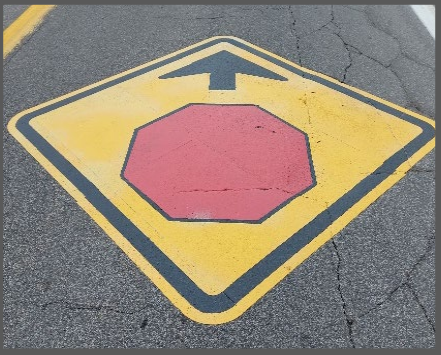
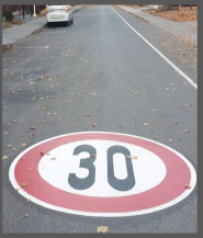
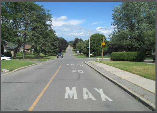
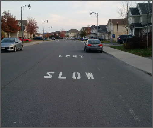
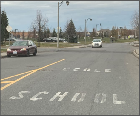
- Pavement markings such as, but not limited to, speed limits, “School/École”, “Slow/Lent”
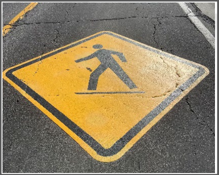
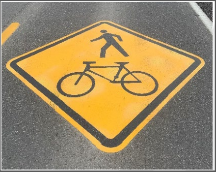
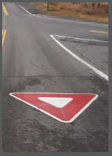
- Thermoplastic Symbols
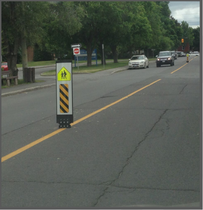
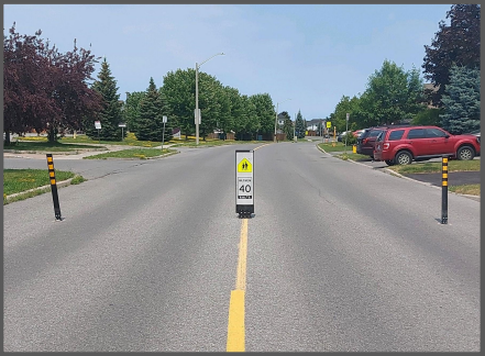
- Flexible centreline signage
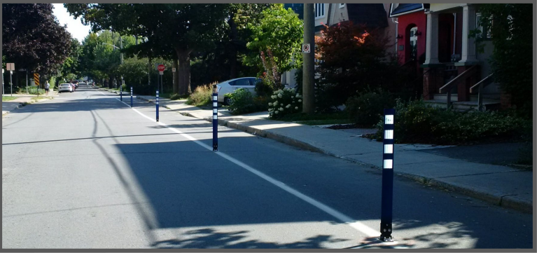
- Cycling delineators
- Warranted Gateway Speed Limit Signs (40 km/h or 30 km/h)
- Community entrance signage
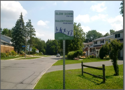
- Permanent “Slow Down for Us” signage
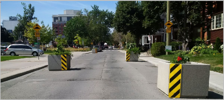
- Planters on local streets to create chicanes
- Flexible posts to create bulb outs or chicanes
- Warranted Pedestrian Crossovers (PXOs).
The following measures may be considered on a case-by-case basis as part of the TTCMP and will be subject to the same location restrictions identified in the City’s Traffic Calming Design Guidelines:
- Improvement of minor roadway deficiencies in rural areas
- Permanent Speed Humps or speed tables
- Median narrowing islands or pedestrian refuge islands.
Flex Stakes and Delineators
Examples of Thermoplastic Symbol
Hover over for Symbol names
Examples of Various Pavement Markings
Flexible posts to create bulb outs or chicanes
Roundabouts
What is a roundabout?
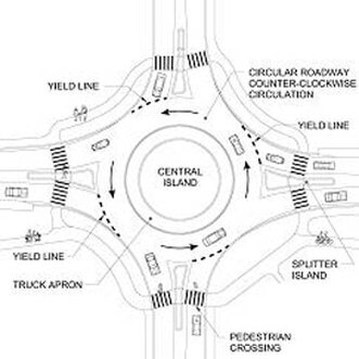
A modern roundabout is a circular intersection that does not have traffic signals. It is designed to maximize safety and minimize traffic delay.
A modern roundabout is a circular intersection that does not have traffic signals. It is designed to maximize safety and minimize traffic delay.
- Low speed on approach
- Approaching vehicles yield to traffic already in the roundabout
- Vehicles drive counter-clockwise and always to the right of the central island
- Low speed on exit
- Continuous movement of traffic
Pedestrians
Roundabouts are often safer for pedestrians than intersections that use traffic signals. At a roundabout, a pedestrian only has to cross two sections of one-way traffic, which is moving at slow speeds. A pedestrian crossing at an intersection with signals must deal with vehicles turning right or left on green, and turning right on red. Some vehicles run the red light, which may result in injuries or fatalities for pedestrians.
At a roundabout:
- Look and listen for approaching traffic. Choose a safe time to cross from the curb ramp to the median opening.
- Walk on the sidewalk/path at all times.
- Never cross the circular roadway to the central island.
- Cross at the designated crosswalk.
- Look in the direction of the oncoming traffic and wait for an acceptable gap before entering the crosswalk.
- Proceed to the splitter island (median) and use as a refuge. Look in the direction of oncoming traffic and wait for an acceptable gap before crossing.
Cyclists
Well-designed, low-speed, single-lane roundabouts should be easy for cyclists to use.
- Ride as if operating a motor vehicle — at the same speed. When riding in a bike lane or on the shoulder, merge into the travel lane before the bike lane shoulder ends. Obey the same driving instructions as vehicles. It is generally safest to claim the lane. Don't hug the curb, ride close to the middle of the lane and be cautious of drivers' blind spots.
- Dismount and use sidewalks and crosswalks. Some roundabouts have a ramp that leads to a shared bicycle–pedestrian path, which runs the perimeter of the roundabout. If there is no shared path, obey the signs, dismount and walk your bicycle.
Motorists
Making a right turn
- Unless posted otherwise, use the right lane if there are multiple approach lanes and turn on the right-turn signal.
- Reduce your speed.
- Keep to the right of the splitter island.
- Allow cyclists to enter the roadway in front of you.
- Watch for pedestrians in the crosswalk or waiting to cross. Be prepared to stop if a pedestrian is already in the crosswalk.
- Move up to the yield line and wait for an acceptable gap in traffic. Do not enter next to someone already in the roundabout, as that vehicle may be exiting at the next exit. (If another vehicle is stopped at the yield line, do not stop on the crosswalk. Keep the crosswalk clear for pedestrians).
- Enter the roundabout when there is an adequate gap in traffic within the circular roadway.
- Within the roundabout, do not stop except to avoid a collision; you have the right-of-way over entering traffic. Keep to the right of the central island and travel in a counter-clockwise direction.
- Do not overtake other vehicles and cyclists.
- Keep to the outside of the circulatory roadway within the roundabout and continue to use your right-turn signal as you exit. If there are multiple exit lanes, use the right-hand lane.
- Maintain your slow speed until you have passed the crosswalk. Watch for pedestrians in the crosswalk or waiting to cross and cyclists on the road as you exit.
Making a left or U-turn (exiting more than halfway around the roundabout)
- Follow the same steps from 1 to i (see above).
- When you have passed the last exit before the one you want, use your right-turn signal and continue to use your right-turn signal through your exit. Maintain a slow speed.
- Watch for leading or adjacent vehicles on the outside (for multi-lane roundabouts) that continue to move around the roundabout.
Moving straight through
- Follow the same steps from 1 to 9 (see above).
- When you have passed the last exit before the one you want, use your right-turn signal and continue to use your right-turn signal through your exit. Maintain a slow speed.
- Watch out for leading or adjacent vehicles on the outside (for multi-lane roundabouts) that continue to circulate around the roundabout.
PXO (Pedestrian Crossovers)
What is a Pedestrian Crossover?
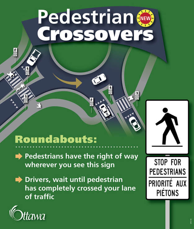
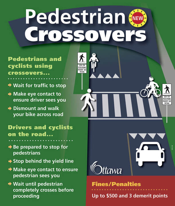
Pedestrian Crossovers are designated areas that allow pedestrians to safely cross roads where vehicles must yield to pedestrians when crossing. Pedestrian Crossovers are identified by specific signs and pavement markings. In some cases, but not always, they may also have pedestrian activated flashing beacons.
At Pedestrian Crossovers equipped with flashing beacons, pedestrians may push a button to make the beacon flash to enhance driver’s awareness that they will be crossing.
It is the responsibility of both drivers and pedestrians to understand and follow the rules at Pedestrian Crossovers.


